The number of structures at risk of flooding in the United States could be higher than previously thought, according to a study published Monday.
The study, published Monday in the journal Earth’s Future, found that 43% of flooded buildings in North Carolina between 1996 and 2020 were located outside the Federal Emergency Management Agency’s Special Flood Hazard Area — areas that FEMA projects have a 1% risk of flooding in a given year.
The findings could help more communities get a better handle on their flood risk and flood insurance needs, experts and authors of the study said. Flood insurance has become increasingly hard to get as some companies increase the price of policies or step back from insuring homes in certain markets due to more frequent and severe weather. That has left property owners more vulnerable.
Experts told NBC News that with access to the right data sources, databases like the one described in the study could be developed nationwide.
FEMA’s maps are the main source nationally to identify flood-prone areas and what structures need to be insured. But experts say the system is outdated and has low resolution. The 100-year flood plain projection doesn’t paint a complete picture of what areas are likely to flood. And climate change has rendered previously authoritative weather and climate projections less reliable, the authors noted.
The study’s use of address-level data allowed the researchers to pinpoint specific buildings that had flooded more than once. That information could help property owners know whether they should be purchasing flood insurance even outside of FEMA’s flood hazard zones, experts said. In the U.S., 99% of counties have flooded at least once but only 4% of homeowners have flood insurance, according to FEMA.
“More information about where it has flooded in the past could help people make different decisions,” said Helena Margaret Garcia, the lead author of the study and a doctoral student at the University of North Carolina-Chapel Hill.
FEMA and the National Flood Insurance Program did not return requests for comment.
FEMA is currently in the process of redeveloping its flood mapping system, through an initiative called the Future of Flood Risk Data, that it says will provide a more comprehensive look at flood hazards and risks in the country using more efficient, accurate and consistent technology.

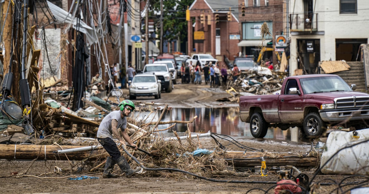
As the planet warms, heavier rainfall is becoming more common because hotter air can hold more moisture, which later falls as rain. Climate change is also leading to a rise in global sea levels, which has made coastal and even some inland areas more vulnerable to flooding. Hurricane Helene, the third-deadliest hurricane of the modern era, caused severe flooding in mountainous areas in the middle of North Carolina. Damage totaled more than $78 billion, according to the National Oceanic and Atmospheric Administration.
Severe rainfall has caused flash floods to rip through towns across the U.S. in the last two weeks, most recently on Monday in New Jersey and New York City. Extreme floods resulted in at least six deaths in North Carolina and more than 100 deaths in Texas. Flash floods are the top storm-related killer in the U.S. resulting in an average of 125 deaths per year in the last few decades, according to the National Weather Service
A North Carolina climatologist said warmer ocean waters, which also feed storms, could have been a factor in fueling last week’s Tropical Storm Chantal, which broke rainfall and river-crest records in the state.
With the changing climate, having access to up-to-date maps is crucial, experts say.
For the study, researchers mapped 78 flood events between 1996 and 2020 using data from the National Flood Insurance Program — the FEMA program through which property owners can purchase insurance for potential flood-related losses. They also used emergency service requests and “volunteered geographic information,” which they acquired through social media posts, to create what they describe as a “first of its kind” database. Data on past floods is often difficult for the general public to access, which can make it challenging for homeowners to know whether their property has previously flooded, experts said.
Garcia said researchers can use the same methods from the study to create similar historical maps for regions across the nation to help officials identify areas in their state they may not have previously thought of as a flood risk.
While the study found that only 20,000 of the 90,000 buildings flooded more than once — more than double the number of buildings that filed NFIP claims — authors of the study are working on research to quantify its human impact. Some are looking at health outcomes, including how a flood might interrupt people’s health care, and others looking into the quantity of displacement due to the repetitive flooding, Garcia said.

Antonia Sebastian, an assistant professor in the department of geological sciences at UNC-Chapel Hill, said the study aims to create a “comprehensive record of past flooding” by gathering data on flood events that don’t make the biggest headlines but still have an impact on homeowners.
“Places that have flooded before will flood again. It’s just a matter of time,” Sebastian said. “And those are all risky places.”
Chad Berginnis, the executive director of the Association of Flood Plain Managers who wasn’t involved in the study, said FEMA’s maps are designed to implement the NFIP by determining what areas have to purchase flood insurance, using the 100-year flood plain as a guide. He said the study’s analysis of historical flooding highlights that officials may need to require flood insurance in areas outside of FEMA’s flood hazard zone.
“FEMA flood maps are a starting point and not an end point,” Berginnis said. “They will show you one kind of flood risk, but if you want a total perception of flood risk, one of the things you got to do is find historical flood information.”
He said replicating similar database models as the one described in the study in other local areas could help flood plain managers increase awareness among their communities about who is at risk of flooding by pinpointing where it has occurred previously.
“Just given the flood history of [the Guadalupe River], and having a daughter of the age that’s going to camps too, I mean, this is really hitting home to me. You know, how is it that we, that societally, we’re not comprehending that these same locations can also be very risky areas and not either demanding or finding out a little bit more about it. So, I think clearly we don’t have enough awareness of flood risks.”
June Choi, a doctoral student in earth system science at Stanford University who was not part of the study, said the finding that many flooded buildings were located outside of at-risk areas designated by FEMA’s flood maps is likely the case across all states. The new database may be limited because it doesn’t factor in how building density changes over time. But its use of historical records and address-specific data still make it a valuable resource for assessing future flood risk, she said.