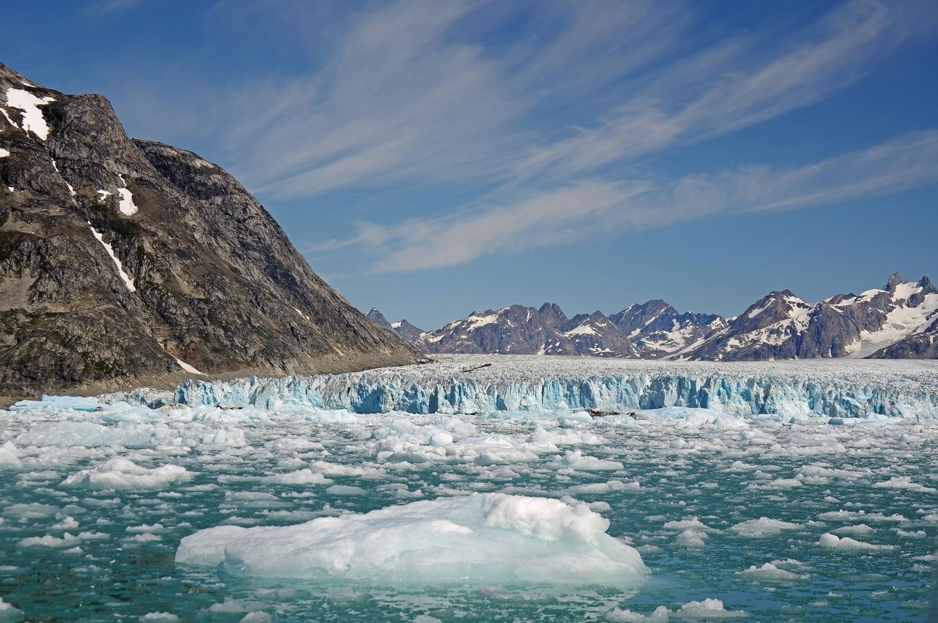

Pieces of ice in front of glacier, barren mountains, Knud Rasmussen Glacier, in far northwest … More
Preliminary data from a NASA-funded Greenland survey point to a two-degree centigrade rise in regional ocean water temperatures in less than a decade.
For the first time ever, a team of researchers took the data from a subglacial Greenland channel in February of this year using a custom-built, remotely operated vehicle equipped with sonar, laser-ranging and a mass spectrometer.
Preliminarily, what we’ve been able to show is, at least during this year, ocean water in this region is almost two degrees warmer than it was less than 10 years ago, Britney Schmidt, a Cornell University astrobiologist and the ongoing Icefin project’s principal investigator, tells me in Reykjavik. It’s crazy amounts of warming; we’re losing this ice very rapidly and it’s much warmer than I would have expected; two degrees in 10 years is insane, she says.
The ROV allows us to find channels that are bringing water out from underneath the ice sheet which has huge climate implications, Schmidt tells me during the recent European Astrobiology Institute’s BEACON 25 conference in Iceland. But it also has astrobiological implications, because you’re bringing samples from under the ice sheet that we otherwise can’t get to, she says.
This ROV exploration is also trailblazing the way for NASA’s potential subsurface lander missions to the icy moons of Europa and Enceladus. At the same time, this research is providing the most current data on climate change in our Northern hemisphere.
One of these glaciers has been moving back at about a kilometer a year; others are moving faster, but this system is quite unstable, so we’re rapidly losing ice, says Schmidt.
NASA-funded and partly funded by the private Simons Foundation, one aim of the research is to simulate the types of exploration, decision making, and analyses that might be required for a mission one of our solar system’s icy moons.
Cornell University astrobiologist Britney Schmidt gives her presentation at the recent European … More
Retreating Glaciers
Working from temporary headquarters atop Greenland’s ice cap, the team made its measurements earlier this year by deploying the ROV into subsurface channels and steering the ROV upstream underneath the ice sheet. The team worked near or on three glaciers, including the Knud Rasmussen Glacier on Greenland’s Northwestern Coast
We’re able to resolve exactly how the ocean is getting into these channels and how much fresh water is affecting the base of the ice, says Schmidt. That allows us to put much tighter constraints on how melting is happening, she says.
Ice Melt
Even so, Greenland has been rapidly losing ice for the last 100 years due to direct human-caused effects in the Northern hemisphere.
Three glaciers are calving (or losing) ice directly into the ocean.
In the cold part of the season, the team can drive out on snowmobiles to these environments, Schmidt explains in her BEACON 25 talk. The team first drills a hole in the sea ice, then we deploy the vehicle vertically through the ice, then drive it under the ice horizontally, as Schmidt explains in her talk.
Future Icy Moon Exploration
The ways in which we’re exploring beneath the ice are analogous to the types of things we’d need to develop to explore Jupiter and Saturn’s icy moons, says Schmidt. You’d melt through the ice shell to be able to pull water samples and decide which samples are interesting and then pass the most interesting ones through to in-situ life detection instrumentation, she says.
At the same time, this work is helping the team develop new sample handling systems that oceanographers and climatologists can use on Earth.
Mass spectrometers pull in samples of material and analyze their chemistry. in this case, it’s what’s called a membrane inlet (semi-permeable) mass spectrometer, says Schmidt. It’s pulling dissolved gases out of the water and analyzing their composition, she says. That allows us to do is to understand what’s going on underneath the ice and measure just how much melting is happening underneath the glaciers, she notes.
This basic research will also help further NASA’s laundry list of tech development needed to manage eventual subsurface sampling of Europa and Enceladus.
How would a subsurface rover on the icy moons of Europa or Enceladus communicate back to Earth?
It would probably need a tether or a set of acoustic transponders that can transit through the ice to allow it to radio back to the surface and then radio out back to Earth, says Schmidt. But it’s possible, she says.
But before such ambitious space missions to Europa or Enceladus, there’s practical work to do here on Earth. One involves enabling AI for the Icefin ROV so that it can make at least some of its own exploration decisions in situ.
We have a long way to go on under-ice robotic autonomy, both from just how to keep vehicles safe to how to understand the environment, says Schmidt. That’s kind of a frontier, not just for space exploration, but also for Earth exploration, she says.