A dust storm approaching Chicago from the south on May 16, 2025.
May 16th, 2025 continues to be an interesting weather day and is keeping meteorologists like me on their toes. Earlier in the afternoon, tornadic storms impacted St. Louis, Missouri, and now there is a Dust Storm Warning issued for Chicago, Illinois. Yes, Chicago.
Dust storm warning for Chicago, Illinois on May 16, 2025.
I did not believe it either until my friend Dr. Tom Gill started posting about it on his social media platforms. Gill is a professor at University of Texas – El Paso and is one of world’s foremost experts on dust. At 6:04 p.m. local time, the National Weather Service in Chicago wrote, “The dust storm continues to race northward at 60 mph and is expected to be entering the southern metro and I-80 within the next 10-15 minutes! New dust storm warning has been issued until 8 PM CDT. Use caution if traveling on area interstates in the warned area!’”
Reports of blowing dust at Chicago Midway Airport on May 16th, 2025.
Dr. Gill’s post was even more illustrative. He posted, “I never thought I’d be saying this before, but… there’s a haboob moving into Chicago!” The Glossary of the American Meteorological Society defined a haboob as, “An intense sand storm or dust storm caused by strong winds, with sand and/or dust often lofted to heights as high as 1500 m (~5000 ft), resulting in a “wall of dust” along the leading edge of the haboob that can be visually stunning.”
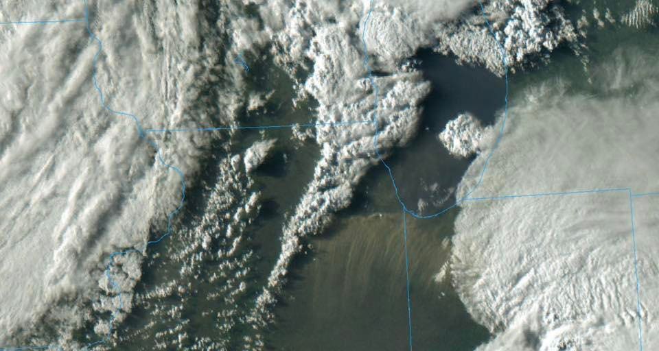
Thunderstorms south of Chicago on Friday evening.
While interesting, it is apparently not unprecedented. A 2025 study documented a large dust storm in Illinois that occurred two years ago. That storm caused an 84-car pileup and led to fatalities. Occurring also in May, bare soil and dry conditions were a key factor in that 2023 storm. For this storm, my immediate hypothesis was related to dry conditions and outflow boundaries racing northward from thunderstorms to the south. Other colleagues throughout social media, including my UGA colleague Dr. John Knox, were offering similar hypothesis.
University of South Alabama meteorologist Jordan McLeod also pointed out that there was a particularly strong pressure gradient at upper levels in the region that could have possibly mixed downward in what meteorologists refer to as a dry slot. The National Weather Service glossary defined a dry slot as, “A zone of dry (and relatively cloud-free) air which wraps east- or northeastward into the southern and eastern parts of a synoptic scale or mesoscale low pressure system.”
When the “dust” settles, I will circle back with a more thorough analysis.
Dry slot feature on May 16, 2025.