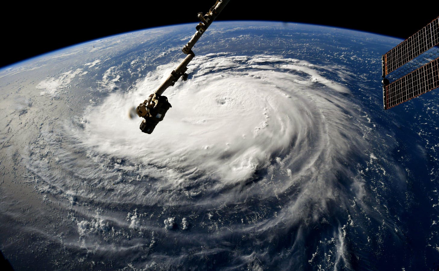

ATLANTIC OCEAN – SEPTEMBER 10: In this NASA handout image taken by Astronaut Ricky Arnold, Hurricane Florence gains strength in the Atlantic Ocean as it moves west, seen from the International Space Station on September 10, 2018. Weather predictions say the storm will likely hit the U.S. East Coast as early as Thursday, September 13 bringing massive winds and rain. (Photo by NASA via Getty Images)
Getty Images
If you have any type of social media account, you may have seen some random “jane” or “joe” sharing long-range projections about a hurricane approaching the U.S. East Coast in the next two weeks. A global AI-based model has been particularly bullish on this scenario. The month of August marks the ramp-period of the Atlantic hurricane season, so I thought it would be valuable to provide three reasons why you should consume that forecast with a grain of salt right now.
Atlantic activity on August 10, 2025.
NOAA and NWS
Before I provide context on what the AI models and others are showing right now, it is useful to set the stage. The Atlantic basin is starting to light up with tropical activity. And it should be. The main development region typically starts to feature more tropical wave and thunderstorm clusters as we move through the month of August. Current satellite imagery shows several potential candidates for the next named storm, Erin.
A deterministic forecast for the ECMWF, GFS, and EC AI model system. The prediction is for the morning of August 21, 2025.
NOAA, ECMWF, and Tropical Tidbits website
What The AI Model Shows Right Now
Models are sniffing out the possibility that one of those waves coming off of the African coast will develop further. A European AI model system has been particularly aggressive with its outlook.
On July 1, 2025, the European Centre For Medium-Range Weather Forecasts announced that the ensemble version of the Artificial Intelligence Forecasting System (AIFS) became operational. It is being run along with ECMWF’s more familiar “Euro” model system, which is a physics-based Integrated Forecasting System (IFS). According to an ECMWF press release, “The ensemble version, called AIFS ENS, is a collection of 51 different forecasts with slight variations at any given time to provide the full range of possible scenarios.” The map above shows deterministic predictions from the standard ECMWF, American GFS, and ECMWF-AIFS for the morning of August 21, 2025. Let’s break down three things about these very different forecasts.
August through October is the busiest portion of the Atlantic hurricane season.
NOAA
3 Reasons To Be Cautious With These Predictions Right Now
There are several important cautions here. First, this forecast is still 11-days out at the time of writing. Credible meteorologists caution against anchoring to model outcomes in the ten-to-fourteen day range. A 2019 Pennsylvania State University study found that the 10-day threshold is where model skill starts to degrade.
One caveat is that study focused on traditional physics-based models in which complex mathematical equations are solved to resolve how the atmospheric fluid evolves in time. AI-based models operate differently. While operating at coarser resolution (31 km) than the traditional system (9 km), ECMWF noted, “The new ensemble model outperforms state-of-the-art physics-based models for many measures, including surface temperature, with gains of up to 20%.” At the moment, it works at a lower resolution (31 km) than the physics-based ensemble system (9 km), which remains indispensable for high-resolution fields and coupled Earth-system processes.
Second, the AI model system has a hurricane near the U.S. East Coast on that date. The American GFS has nothing at all, and the standard European system has a storm well off the coast. This looming system will be an early test for the AIFS ENS, which according to ECMFW, “Relies on physics-based data assimilation to generate the initial conditions…. Can generate forecasts over 10 times faster than the physics-based forecasting system, while reducing energy consumption by approximately 1,000 times.” Last year, AI-based models outperformed some traditional ones with landfall location or lead-time associated with Hurricane Beryl and Hurricane Francine.
HOUSTON, TEXAS – JULY 08: A vehicle is left abandoned in floodwater on a highway after Hurricane Beryl swept through the area on July 08, 2024 in Houston, Texas. Tropical Storm Beryl developed into a Category 1 hurricane as it hit the Texas coast late last night. (Photo by Brandon Bell/Getty Images)
Getty Images
Third, I only showed a deterministic “average” solution, but I did so for a teachable moment. Many “social mediarologists” (and some trained meteorologists) post such cherry-picked solutions all of the time. In reality, if you look at the ensemble spread of the solutions right now, even the AI scenarios still have a wide range of track or intensity possibilities. In the post below found on the platform X, you see the actual spread of the ensemble members on August 8, 2025.
As a reminder, the NWS glossary defined an ensemble forecast as, “Multiple predictions from an ensemble of slightly different initial conditions and/or various versions of models…. Objectives are to improve the accuracy of the forecast through averaging the various forecasts, which eliminates non-predictable components, and to provide reliable information on forecast uncertainties from the diversity amongst ensemble members.” I showed single deterministic runs in this article to make a point. However, if you see someone post one on social media, especially beyond 10 days, and make wild claims, you should be cautiously skeptical.