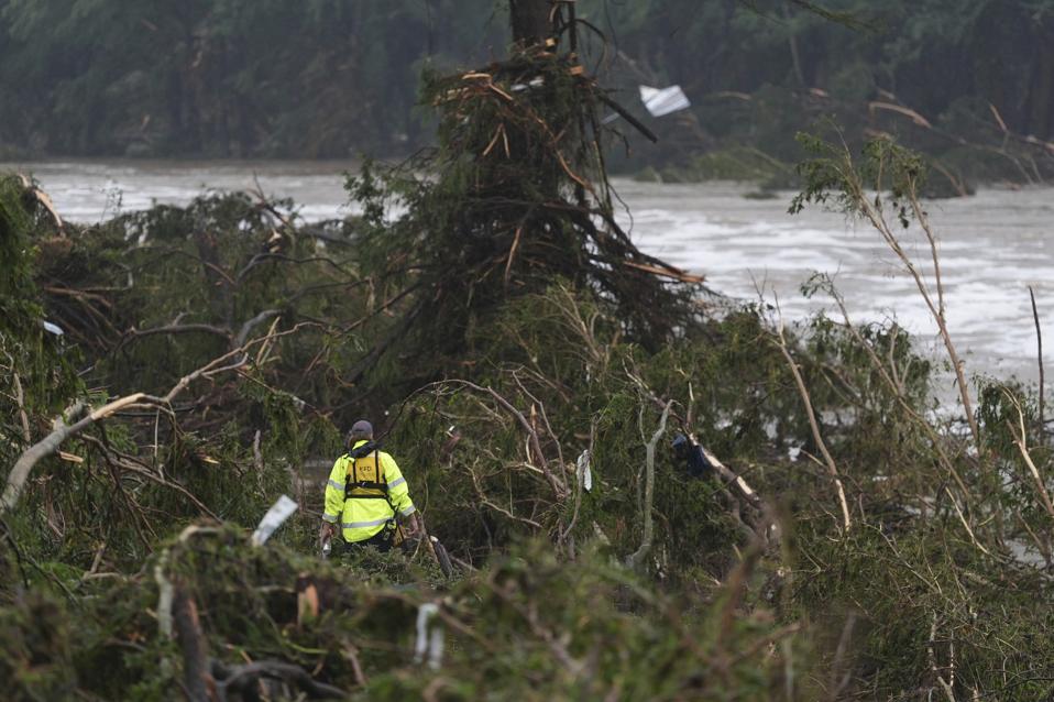
A first responder searches an area along the Guadalupe River that hit by flash flooding, Friday, … More
Catastrophic flooding has devastated a region that is no stranger to these types of events. Media reports are confirming multiple fatalities. Many people are still missing including 20 girls at a summer camp along the Guadalupe River. Many people were asking if this “came out of nowhere” and whether there were warnings. Here’s my perspective as a meteorologist.
Meteorologist James Spann posted on his Facebook page, “Many have asked about warnings for the floods in Central Texas responsible for the deaths of over two dozen people late Friday night into Saturday morning…. Warnings were issued by NWS Austin, and they seemed timely and proper” I want to further explore this, but it is critical for readers to understand that a full review will be conducted at a later date. My analysis here is simply a “first look” given all the rumors, accusations, and “social mediarologists out there.
Flash flood warnings issues in the early morning hours of July 4, 2025.
The National Weather Service Austin/San Antonio issued a Flash Flood Warning at 1:14 AM CDT for Bandera and Kerr Counties, respectively. They made statements like, “Life threatening flash flooding of creeks and streams, urban areas, highways, streets, and underpasses.” That warning also specifically identifed regions like Kerrville, Ingram, Hunt, Waltonia, Kerr Wildlife Management Area, and Lost Maples State Natural Area.
At 5:34 am Friday morning, the NWS issued a Flood Emergency for much of the region. The warning stated, “Automated rain gauges indicate a large and deadly flood wave is moving down the Guadalupe River.” The NWS communication urged people to seek higher ground.
Flood Emergency was issued at 5:34 am CDT on July 4, 2025
This is a tough situation because many of these warnings are happening in the middle of the night. What as the NWS leading up to these events. I went back to a NWS discussion issued on Thursday afternoon because several things caught my meteorological eye. They wrote, “A substantial plume of deep tropical moisture continues to stream north across South-Central Texas, characterized by unseasonably moist precipitable water values as high as about 2.4 inches…. The 12Z Del Rio upper-air sounding this
morning observed a PW of 2.31 inches, which is near daily record high values.” The discussion went on to say, “The axis of a negatively tilted mid-level trough most readily apparent on 700mb analyses is beginning to move poleward towards the Edwards Plateau, leading to rounds of shower activity throughout South-Central Texas into tomorrow as the advancing trough prompts the ascent of moist air.” A feature called a mesoscale convective vortex was also a key player in this event.
Satellite data shows the plume of moisture extending into Texas.
Let me decipher some of the meteorological jargon. Precipitable water is measure of atmospheric moisture. It is the equivalent depth of water that would be measured if condensed and precipitated out of a column of the atmosphere, according to the NWS. As meteorologists, we are always alert to exceedingly high values because they indicate a lot moisture. The MCV and presence of the trough signaled the presence of other ingredients needed -a focusing mechanism and rising motion. NWS forecasters were aware of these signs too. They wrote on Thursday afternoon, “Rainfall totals of 1 to 3 inches appear likely, but locally higher amounts upwards of 5 to 7 inches could materialize if slow-moving storms begin to cluster…. A Flood Watch is now in effect through 7 AM Friday morning for the southern Edwards Plateau and western Hill Country, where the intersection of higher forecast rainfall amounts and rainfall from the past few days is most evident.”
Heavy rainfall and a mesoscale convective vortex on July 4, 2025.
I decided to take an even longer view. NOAA’s Weather Prediction Center issues a Day 3 to 7 U.S. Weather Hazards Outlook. If you look at the hazard map issued on June 30th, which is several days ahead of the flooding event, a heavy rain region is predicted for July 3rd. It is clear to me that NWS forecasters sniffed out this potential 4 or more days in advance of the disaster.
Day 3 to 7 hazard outlook issued on June 30, 2025.
Balanced Weather meteorologist Alan Gerard also discussed other aspects of this flood event. In his blog, he said, “The Hill Country of central Texas is known colloquially as “flash flood alley” because of its high frequency of major flash floods. The region is particularly vulnerable to major flash floods because of the frequency of intense thunderstorms that can produce extreme rainfall rates in the moist Gulf air combined with terrain that favors rapid runoff into flashy rivers and streams.”
Interestingly, a 2023 study published in Natural Hazards examined over 6000 flood events in flash flood alley from 2005 to 2019. They found that fatalities and injuries in the were surprisingly rare (2% occurrence rate). They considered environmental (topography, soil type, land use), climatic (rainfall attributes), and situational (activities, timing, location) factors to provide a predictive model. They found that vehicle-related activities were the strongest indicator of likely harm. L Strongest impact on the probability of harm. Proximity to low water crossings and flash flood alley also increased risk. Finally, nighttime events like this one were also found to be dangerous.
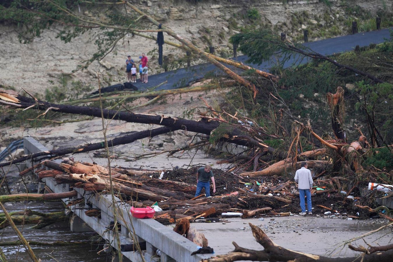
A raging Guadalupe River leaves fallen trees and debris in its wake, Friday, July 4, 2025, in … More
This a tragic event. I have that pit in my stomach as a meteorologist because events like this represent a worst-case scenarios at the convergence of the very factors considered in the study. Meteorology professor Jordan McLeod even pointed out that this event happened within the context of drought. Why does that matter? Flooding is not simply a function of what falls from the sky. The land cover matters. McLeod, who works at the University of South Alabama, speculates that the drought-stricken landscape would accelerate runoff into the streams and rivers in a manner similar to paved surfaces.
Time will reveal the factors at play, but this is another example of compound, extreme weather events that have significant societal impacts. While I conclude that there were adequate warnings from a meteorological perspective, the outcomes illustrate known challenges with forecasting and communicating extreme events:
- Messaging nighttime events. It is important to have a “night plan” and weather situational awareness before going to bed.
- Conveying probabilistic risk associated with rainfall events. Our models and expertise can sniff out the broad parameters, but the precise location and timing of moisture plumes, training (quasi-stationary rain cells), and forcing mechanism can be difficult.
- Did people receive the information and how was it consumed? Even if information is out there, there are a wide range of consumption patterns. Some people may not see information at all. Others may receive information and make calculated risks based on circumstances or motivated reasoning. Such questions are at the heart of the social sciences research in meteorology.
I will close with this an important point. The NWS issued critical warnings during nocturnal hours as this event unfolded. Weather and its risks are 24/7, so we must ensure that our NWS offices are fully staffed 24/7 too.
Drought conditions in Texas as of July 1, 2025.