
A magnitude 6.0 earthquake hit Afghanistan’s eastern region on Sunday midnight, followed by a series of aftershocks. Non government agencies like the International Rescue Committee and Caritas report widespread damage, worsened by heavy rain and floods in the region. The Taliban regime confirmed 800 people were killed, with many people injured or still missing.
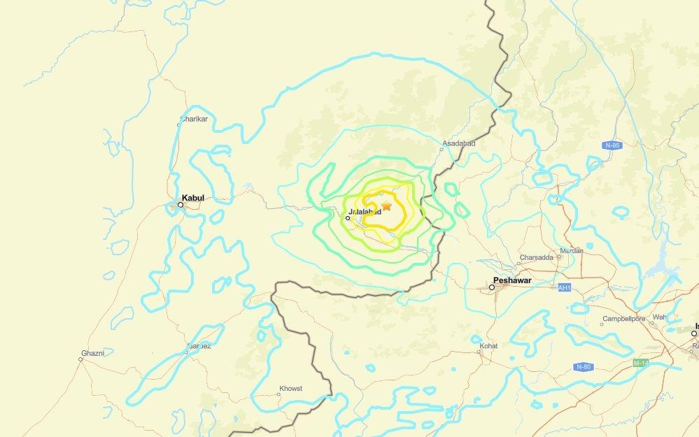
USGS reported that the earthquake occurred 27 kilometers (16.77 miles) north-east of Jalalabad, in Nangarhar Province, and at a depth of 8 kilometers (4.97 miles).
Afghanistan is frequently hit by earthquakes, especially in the Hindu Kush mountain range, which lies near the junction formed by the former Tethys Ocean and now squeezed together between the Eurasian and Indian tectonic plates.
Research published in 2008 links the seismic activity to a slab of oceanic crust sinking into Earth’s mantle. As the slab sinks downwards at a steep angle, large portions or rock break off from the slab’s tip. The remaining slab rebounds and moves upwards, triggering a superficial fault network stretching west, resulting in shallow (less than 200 kilometers deep) earthquakes. In combination with poor construction standards, most building in rural areas are made of mud bricks, this seismic activity can cause widespread devastation.
Plotting earthquake hypocenters — for example using online apps like Seismic Explorer — one can show how the subducting oceanic plate (shown in green) is pulled down beneath the continental plates. This movement deforms a fault network stretching west, where shallow earthquake occur (shown in orange and red).
Bressan
Bressan/Seismic Explorer