Three Category 5 storms, one of the most powerful hurricanes ever recorded, zero U.S. landfalls and a mystifying lull at the usual peak of activity: Together, these and other factors made for a “screwball” hurricane season this year.
That’s how atmospheric scientist Phil Klotzbach put it, anyway.
“It was just a strange year,” said Klotzbach, who studies hurricanes at Colorado State University. “Kind of a hard year to characterize.”
Hurricane season comes to its official close on Nov. 30. In some ways, 2025 fits what researchers expect to see more often as the climate warms: Hurricanes continued forming late into the season and several intensified at extreme rates to produce some of the most intense storms in history.
But in other ways, it was simply odd. Fewer hurricanes formed than experts predicted, but almost all of them became major storms. And the continental U.S. was spared a landfall for the first time in a decade. The surprises were a reminder of hurricane season’s unpredictability — particularly in a warming world — even as forecasting gets more accurate.
Fewer hurricanes, higher intensity
Forecasters at the National Oceanic and Atmospheric Administration in May predicted an above-average season with six to 10 hurricanes. Of those, at least three were expected to be major storms, meaning Category 3 or above, with sustained winds at or above 111 mph.
Klotzbach came up with the same forecast independently, and other hurricane-tracking groups were in the same ballpark.
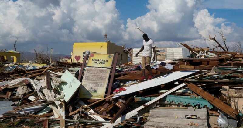
In the end, fewer hurricanes formed, but of the five that did — Erin, Gabrielle, Humberto, Imelda and Melissa — four were considered major.

“That’s the highest ratio there’s been in the past 50 years,” said Brian McNoldy, a hurricane researcher at the University of Miami’s Rosenstiel School of Marine, Atmospheric, and Earth Science.
What’s more, three of those major storms were Category 5, the highest level of intensity.
Forecasters’ predictions of an above-average season still proved accurate despite the lower number of storms because of a metric called accumulated cyclone energy — essentially a calculation of the overall intensity and duration of all tropical storms in a season.
Klotzbach predicted the accumulated energy would be 125% of the 30-year average. The season ended up at 108%, which, given the low number of hurricanes, means each packed a punch.
“It was a quality season, not a quantity season,” he said.
Nine of the past 10 Atlantic hurricane seasons have been above normal, according to Klotzbach, who attributes the trend to high ocean temperatures and La Niña, a seasonal circulation pattern that tends to weaken the high-altitude winds that discourage hurricane formation.
McNoldy, who closely tracks Atlantic water temperatures, said 2025 was “anomalously warm.”
“Whatever storms were out there definitely had a lot of fuel to tap into,” McNoldy said. Ocean heat drives evaporation, causing warm, moist air to rise from the surface to create convection; hurricanes require ocean temperatures of at least 79 degrees Fahrenheit to form.