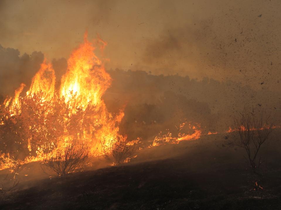
Firefighters battle to contain the wildfire in Ventura County, California, the United States, Aug. 7, 2025. Dubbed the Canyon Fire, it originated near Piru in eastern Ventura County, close to Los Angeles. (Photo by Qiu Chen/Xinhua via Getty Images)
Xinhua News Agency via Getty Images
Wildfire disaster are expensive, and they keep happening. The cost of human life, property and the environment is catastrophic. In February 2024, the Smokehouse Creek Fire in the Texas Panhandle destroyed over 1M acres. A February 2025 report from Texas A&M estimated that over the past 20 years, Texas experienced 243,969 wildfires that have burned over 13.9 million acres and destroyed 5,374 homes. The economic impact of wildfires in the U.S. is staggering, in the range of ~$1T/year. The toll on human lives (firefighters and the public) and the environment is also significant, with estimates of ~15,000 lives lost in 2006-2022 due to smoke inhalation alone.
If the normal course of action is to wait until a wildfire happens, assemble thousands of brave firefighters to fight the threat, deploy equipment, and manage the growth of the fire, it is too late. There is smarter way. Leveraging the innovations and advances in sensing, robotics, drones, data & weather science, and of course, AI can enable solutions to mitigate nascent threats before they occur. The good news is that the technology is here. It just has to be implemented in a cost effective way.
SBC Fire Protection Chief, Dan Munsey, is a 30-year firefighting veteran. He is also an acknowledged expert on wildfire management and has testified at the U.S. Congress on multiple occasions. Recently, he testified to the House Natural Resource Committee on 26 June, 2025 at an oversight hearing titled “Fix Our Forests: Advancing Innovative Technologies to Improve Forest Management and Prevent Wildfires.” The Committee recognized the need for technology and innovation to proactively detect and mitigate wildfire threats.
Chief Munsey’s vision is to “is to keep fires to 100 square feet or less, 90% of the time”. Current target metrics are ~500,000 sq. ft., 90% of the time. The 5,000X vision is aggressive and needs technological innovation which he has tirelessly lobbied for and organized action around. An upcoming effort is his leadership in organizing a consortium of partners to demonstrate how to do this using a combination of technologies. This demo is expected to launch over a 6 month period starting in October 2025. All partners in the consortium are ready. It is awaiting FAA approval since it deployment of BVLOS (Beyond Visual Line of Sight) drones flying at high altitudes for extended time periods.
The baseline solution today is manned aviation surveillance that updates firefighters on the ground through radios, and occasionally transmits a short video feed or imagery. It is a static way of communicating in a dynamic fire environment, and does not allow sustained proactive situational awareness. And it is very expensive. Unmanned helicopters have also been used in demonstrations (Figure 1). At a recent event, Chief Munsey worked with multiple partners to showcase the operation of an autonomous Blackhawk drone named Rain to suppress fires.
Figure 1: A Blackhawk Drone Helicopter Demonstrating Wildfire Suppression
SBC Fire, Rain.aero & Sikorsky
Such helicopters are expensive and scarce, not economically feasible for sustained proactive surveillance over large areas for long periods of time.
DZYNE’s Unmanned Long Endurance Tactical Reconnaissance Aircraft
DZYNE is a California-based, autonomous defense company, established in 2012. It is entirely self-funded through U.S. Government Department of Defense (DoD) contracts, and is a defense prime serving the U.S DoD needs for multi-day, persistent high altitude, drone surveillance. It is staffed by ~ 300 employees composed of pilots, fight operations and drone design specialists. The design philosophy is to design their drones using existing, certified components, which disrupts with cost and speed to deployment. All drones are manufactured in the United States in certified facilities.
The United State Airforce funded the development of the LEAP (Long Endurance Aerial Platform) autonomous drone (30 hour endurance, 350 lb. payload, 17,000 feet) and has been deployed globally for various defense ISR (Intelligence, Surveillance, and Reconnaissance) missions. The ULTRA (Unmanned Long Endurance Tactical Reconnaissance Aircraft) is more advanced with a 80 hour endurance, 25,000 ft altitude operation and 450 lb. payload. Compared to other drones like the Predator and Reaper, the cost of a LEAP and ULTRA is much lower (~$7M vs $35-60M). Operating costs are also much lower. Certified pilots are still needed to coordinate drone airspace and communicate with other aircraft traffic operating at these high altitudes. However, the actual operation of the LEAP and ULTRA is completely autonomous (Figure 2).
Figure 2: DZYNE’s ULTRA Uncrewed Aerial System
DZYNE Technologies
The payload consists of multi-spectral cameras, long range radar and anti-jamming GPS. It also uses satellite-based command and control. The focus on dual-use technologies applications encouraged by the DoD has enabled DZYNE to serve other markets in the commercial and public safety arena.
Matt McCue is the founder and CEO of DZYNE. An aeronautical engineer by training, he has worked at major defense primes like Northrop Grumman and Lockheed, and leveraged this experience to start DZYNE in 2012. As a lifelong resident of Southern California, he has first-hand experience with the devastation caused by wildfires, and considers it incumbent to help address this in innovative ways. “DZYNE is proud to deliver persistent, real-time airborne fire detection capabilities through our cost-disruptive ULTRA platform. In partnership with the San Bernardino County Fire Department, our multi-day UAS will provide mission-critical, real-time situational awareness to frontline heroes and water bomber teams to enhance wildfire response”.
American Jet Center – Every Life Matters
Easily one of the most unique, human-focused companies out there. Their business goal is to save lives (seriously!) and they do this through a fleet of ~50 manned and unmanned aircraft (including helicopters) distributed across the United States. These are generally purchased or re-purposed aircraft, used to perform activities like rapid human organ distribution from point A to point B. Their operation centers are less than two hour’s flight time from anywhere in the Continental United States, critical for time-sensitive operations like organ transport (the typical interval between organ rescue to transplant has to be < 24 h hours). Other applications include security and fire prevention.
American Jet Center is headquartered in Southern California and provides integrated flight operations for a variety of applications across locations in the United States. For the effort led by Chief Munsey, it will provide certified pilots and flight operations for this program, including the DZYNE ULTRA drones. Figure 3 is a snapshot of its operations:
Figure 3: Top Left: Surgeon and Pilot with a Transportation Kidney Box; Top Right: Ultra Long Range Drone & Fighter Jet; Bottom Right: Control & Command Center in Southern California for Unmanned Operations; Bottom Left: Private Hat Chino Airport, South California
American Jet Center
Denis Mouterde, the founder and CEO is an ex-firefighter and believes his company’s participation in this endeavor is a moral calling. “Its a responsibility – to stand behind and support those who selflessly dedicate their lives to the safety and well-being of our communities. We are proud to work alongside true community servants, through carrying forward a legacy built on service, integrity, and compassion.”
FNN and Its Ground Based Lightning Detection Detectors
A previous article had discussed FNN and their ground based lightning detectors. It is a venture-backed company that germinated out of research in 2021 at the University of Florida, and co-founded by a team of graduate students (CEO Dr. Istvan Kereszy, Tamas Kereszy and V.P. of Business Development, Caroline Comeau). In many parts of the United States, lightning is a dominant cause of wildfires. Per CalFire, ~82% of acres burned due to wildfires in 2023 were related to lightning strikes. Lightning is also a significant cause of wildfires in other parts of the United States (over 50% of such fires according to ESRI). Smoke from primary wildfires along with weather create conditions for lightning, creating a continuous current with durations ranging from tens to hundreds of milliseconds and amplitudes from several tens to a few hundreds of amperes. The core intellectual property that FNN has commercialized is the High Risk Lightning Detector which detects these current profiles over a 20 mile radius and within 40 seconds of the strike. Networks of these sensors are already deployed in Florida, San Bernadino County, Montana and other U.S. and international locations.
Figure 4 shows how these detectors operate within a larger safety framework.
Figure 4; ConOps of he the FNN Detector
FNN
Current detected by the High Risk Lightning Detectors is processed along with ~25 different environmental data sources through an AI pipeline. The result is a risk assessment of fire which is provided to pilots, drones and ground based firefighting personnel through a real-time dashboard called Foresight.
For the new effort with Chief Munsey, this information will also be provided to Ororatech, a 2018 venture funded company in Germany, with global operations and presence. The focus is on providing high-fidelity data for fire and disaster management. One core technology is their thermal imaging cameras, specifically tuned to detect latent and active fires, and mounted on a network of Low Earth Orbit Satellites (LEOS), with on-board, edge- processing capabilities. Based on this and FNN’s data, low latency alerts are issued to firefighting resources. Ororatech is a partner in the upcoming effort in Southern California.
According to FNN’s co-founders, Ms. Comeau and Dr. Kereszy, “We have been working with San Bernardino County since 2023 under the leadership of Chief Munsey to integrate FNN High-Risk-Lightning detection systems with leading AI robotic systems to verify and extinguish fire hazards. The upcoming demonstration serves as a true example that can inspire the Department of the Interior National Wildfire Technology Roadmap.”
UCSD – Physics and Artificial intelligence to Spot Wildfires
The University of California at San Diego (UCSD) specializes in bringing all the real-time data from drones, ground-based, airborne and satellite-based sensors to provide actionable, predictive data to mitigate disasters. In addition to the real-time data, it also integrates other weather related data (wind speeds, pressure, temperature, etc.) and uses all of this in as inputs to its physics (developed by the U.S. Forest Service) and AI-based models. A key capability is the development of robust workflows that integrate all data, models and collaborative hazard science contributions from various researchers to work in real-time. Dr. Ilkay Altintas is Chief Data Science Officer at San Diego Supercomputer Center and the Founding Director for the Societal Computing and Innovation Lab (SCIL) , which integrates these workflows. According to Dr. Altintas, wildfire disaster mitigation, needs the following:
- Continuous monitoring: to gain tactical site-specific insights.
- Site specific, high resolution streaming data: that local and regional responders can use in real time.
- Use of drones: to provide localized, high-resolution, and flexible data streams
- Partners with diverse expertise: to test a new, integrated system that is practical and scalable.
- Refining earlier models: by adding continuous drone, satellite and ground-based fire hazard testing-based sensing
- Use of digital twins and closed-loop modeling: integrating real-time data with other datasets, and tools like WIFIRE’s Firemap enables real-time digital twin simulations, a powerful tool to train AI based models.
Figure 5 shows the FIREMAP application which provides actionable output of the workflows, real-time data, AI, and digital twin modeling for wildfire mitigation. It provides real-time information to wildfire responders:
Figure 5: FIREMAP Application Example Provides Real Time Information to Wildfire Responders
UCSD
Dr. Altintas believes that “The future of disaster mitigation depends on continuous, high-resolution monitoring that gives us the ability to act before hazards turn into disasters. The pilot demonstration with San Bernardino County will be an example of research and operational expertise coming together to build a scalable model that can be replicated across California and beyond. It is also aligned with our mission to create breakthrough technological innovations that address complex societal challenges through cutting-edge science, data and computing.
San Bernadino County Fire (SBCF)
It is a paradoxical that if demonstration of this technology integration proves the economic value of of the effort in terms of cost savings, firefighting organizations like SBCF would lost their budgets. The trick is to structure the innovation activity into a business framework and prove the cost avoidance argument to ensure sustained funding for proactive wildfire detection than post-disaster management.
A recent article shows how aerial LiDAR mapping pre and post disaster can be used to quantify the economic impact of such fires (applied to the January 2025 events that transpired in Southern California). Led by researchers from UC San Diego and University of Arizona, it discusses how such data can be used to quantify the economic costs of such disasters after they occur. It may be too late to include airborne LiDAR mapping in the ULTRA payload at this point, but is certainly something to consider in the future. The technology exists, and has been deployed on numerous DoD and civil mapping missions. Real time topographical LiDAR data of latent disasters can “easily” be modeled to extrapolate the economic savings of “What if we never proactively managed to suppress the wildfire calamity”.
Closing Thoughts
Wildfire disasters need to be managed before they become wild or disasters. The technology exists now to do this. Entrepreneurs are coming forward to help. There is a lesson here. Sometimes, it is a matter of moral conscience to channel your innovation to save lives and the environment. Its not a question of “Do we have the technology to do this, and should we do this? Its whether we have the will to do it”.
Chief Dan Munsey’s tireless and motivational efforts have convinced all the innovators above to participate in this ground-breaking demonstration to solve a significant societal challenge: “With the integrated efforts of innovators ranging from the sustained aerial situational awareness drone to satellites and ground-based sensors, along with the AI and data science decision-making to achieve proactive wildfire mitigation before it becomes a disaster is not a nice to have tool, it is a must have tool.” Hopefully, government agencies and regulators (like the FAA) will understand the impact of this and act soon.
Jeff Alexy, Robotics Manager at SBCF: “As pioneers in bringing unmanned aerial vehicles into the fire service, the addition of sustained aerial situational awareness aircraft is a transformative step forward, carrying us into the future of firefighting with innovation and vision.”