
Developing low off the Southeast coast.
The National Hurricane Center is watching a low pressure system developing just off the southeastern coast of the United States. All week, forecast models indicated the possibility of a low pressure system forming to the east of Florida and potentially affecting Georgia and the Carolinas. It’s looking better organized. Here’s the latest information.
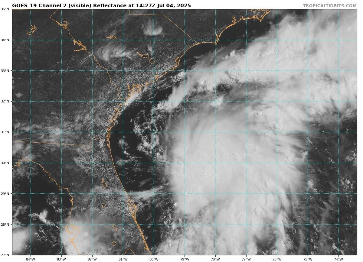
Storm bands approaching the Southeast coast on July 4, 2025.
National Weather Service radar is indicated that squall bands are starting to scrape the Georgia, South Carolina, and Florida coastlines. Satellite imagery also illustrates an emerging canopy of deep convective clouds with showers and thunderstorm about 100 miles off the northeast Florida coast. The National Hurricane Center wrote Friday morning, “Environmental conditions are forecast to be marginally conducive for further development, and a short-lived tropical or subtropical depression could form late today or on Saturday while the system drifts northward.” Sea surface temperatures are relative warm under the storm, but the wind shear is less favorable for significant development.
Whether it develops into a depression or not, the low is expected to move inland over the southeastern U.S. either Saturday night or early Sunday. The main impact of the system will be heavy rainfall, periodic lightning, and flooding. According to NOAA, an Air Force Reserve Hurricane Hunter aircraft will investigate the storm, currently being referred to as Invest 92L, later in the day. Current formation probabilities sit at 60 percent.
Sea surface temperatures and wind shear conditions off the southeastern U.S. coast on July 4, 2025.