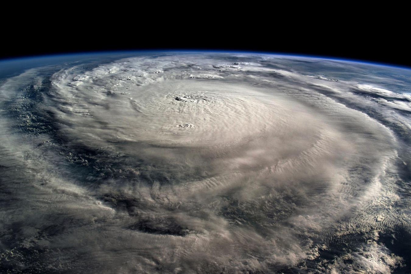
Hurricane Milton, a Category 5 storm at the time of this NASA photograph, is pictured in the Gulf of … More
This week marks the official start of the Atlantic hurricane season, a date that should resonate not only with meteorologists and emergency managers, but also with every business, homeowner and community leader along the Atlantic and Gulf coasts. While the historical peak of hurricane activity arrives later in the summer, in some years, we’ve seen storms form well before the official start. That is why June should be considered more than a ceremonial marker, but a call to pay attention, to stay informed, and to act early.
Shifting Trends In Early Season Storms
Between 2015 and 2021, the Atlantic hurricane season delivered an unprecedented string of early season named storms, each forming before the traditional June 1 start date. This stretch began with Tropical Storm Ana in May 2015 and included the extraordinary formation of Hurricane Alex in January 2016, an event that hadn’t been seen since 1938. From 2015 through 2021, every season had at least one named storm form in May or even earlier, a testament to how warm waters and neutral to La Niña conditions had created a fertile environment for early development.
The development of the first tropical storm of the season has transitioned back to a June or later … More
A Shift In Seasonal Storm Patterns
Yet, 2022 to the present season, have signaled a break from this pattern. In 2022, Tropical Storm Alex arrived on June 5, and in 2023, Tropical Storm Arlene formed just one day into the official season on June 2. Last year took an even more notable turn, with Tropical Storm Alberto not forming until June 19, the slowest start since 2014.
With 2025 continuing this trend, these later starts mark a significant shift from the previous pattern of early storms and suggest that the conditions favoring May development may be giving way to new climate signals.
Strong upper-level winds, known as wind shear, have been more active in recent springs, disrupting the delicate balance that typically allows tropical systems to organize. In addition, 2023 and 2024 featured a powerful El Niño, which tends to strengthen westerly winds in the Atlantic, making early development less likely.
Another very important factor in early season storm suppression are huge dust clouds from the Sahara Desert, carried across the Atlantic all the way to the United States. The latest dust storm is expected to reach the Gulf states this week. All these factors combine to illustrate that while early storm formation can offer a clue about springtime atmospheric patterns, it does not tell the whole story of a season’s eventual activity.
Tropical Ingredients
The recent shift to the first storm forming after the start of the season, compared to just a few years ago when storms regularly formed before June 1, highlights how dynamic and unpredictable hurricane forecasting can be. While the timing of the first named storm each year provides valuable insight into springtime atmospheric patterns, it does not offer a complete forecast of what the rest of the season will bring.
After all, 2023 had a slow start yet ended as one of the most active seasons in memory. The real drivers of a season’s intensity are the interplay of warm sea-surface temperatures, mid-summer wind shear, the Saharan dust layer reach, and the broader state of the El Niño–Southern Oscillation (ENSO).
Some of the necessary conditions for storm development are already in place. By spring, we were already seeing record warm ocean temperatures as evidenced by the earliest 90-degree water temperature reading in history at Virginia Key, Florida, just off the coast from Miami.
Trends In Hurricane Forecasting
New approaches to forecasting tropical storms are reshaping how we understand and respond to these formidable systems. The emergence of artificial intelligence models, such as Microsoft’s Aurora AI project, are providing powerful tools for sifting through massive datasets and delivering more precise storm projections. This cutting-edge technology uses machine learning algorithms to find subtle patterns in atmospheric and oceanic data, offering earlier and more accurate predictions of storm development and intensification. Meanwhile, DTN, the company I work for, recently launched the Hurricane Threat Index to look beyond just wind speeds and surge at landfall.
This index incorporates impacts well inland, recognizing that the heaviest rainfall and strongest winds often extend far from the coastline, as recent storms like Harvey and Florence have demonstrated. The model also elevates the importance of multiple risks associated with a hurricane. For example, Hurricane Helene made landfall as a Category 4 hurricane in Florida’s Big Bend region, but the most catastrophic impact occurred in western North Carolina after Helene weakened to a tropical storm. Within the threat index both the hurricane and subsequent flooding would rate a high severity risk and communicated as such to those potentially impacted.
These advances in technology and methodology ensure that forecasts are more holistic and more relevant to the evolving risk landscape, helping decision-makers better prepare for the full range of storm threats.
Readiness For What Lies Ahead
As the 2025 Atlantic hurricane season begins, we’re reminded that storms don’t always follow the patterns of the past. The seven-year stretch of early-season storms, followed by recent seasons with later starts, clearly illustrates how climate variability and long-term changes continue to reshape our understanding of risk. As we stand on the brink of this new season, let’s treat June 1 not simply as a date on the calendar, but as a call to action: to plan, and to stay vigilant. In the face of nature’s power, preparation remains our most effective and enduring defense.


